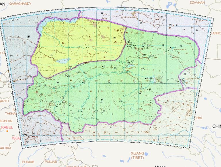
![History map of the Chief Official of the Western Regions Wusun and in the three Kingdoms period]()
History map of the Chief Official of the Western Regions Wusun and in the three Kingdoms period
Map Introduction The historical evolution of the Wusun Kingdom during the Three Kingdoms period primarily involved its interact...2016-10-24 11:29:00 UTC![Map of Wei and Jingzhou during the Three Kingdoms period of China]()
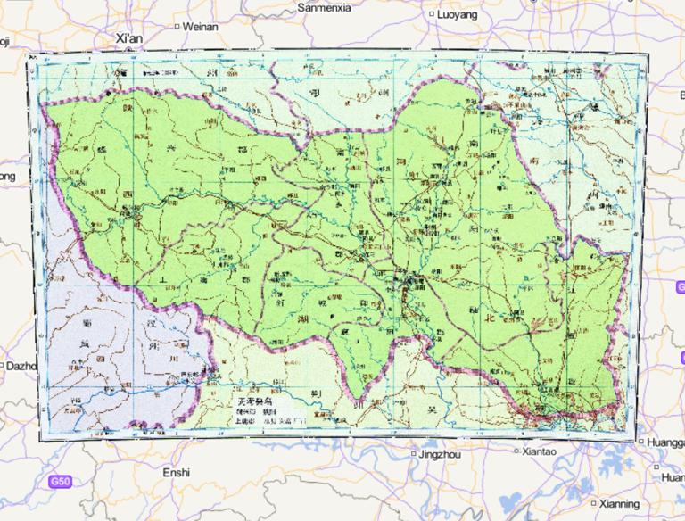
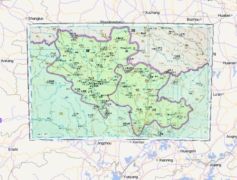
Map of Wei and Jingzhou during the Three Kingdoms period of China
Map Introduction The Cao Wei regime's control over Jing Province during the Three Kingdoms period evolved from initial occupati...2016-10-24 11:29:00 UTC![The Historical Map of Wei State Liangzhou in the Three Kingdoms Period of China]()
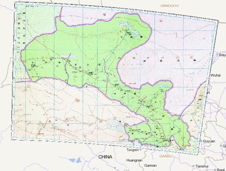
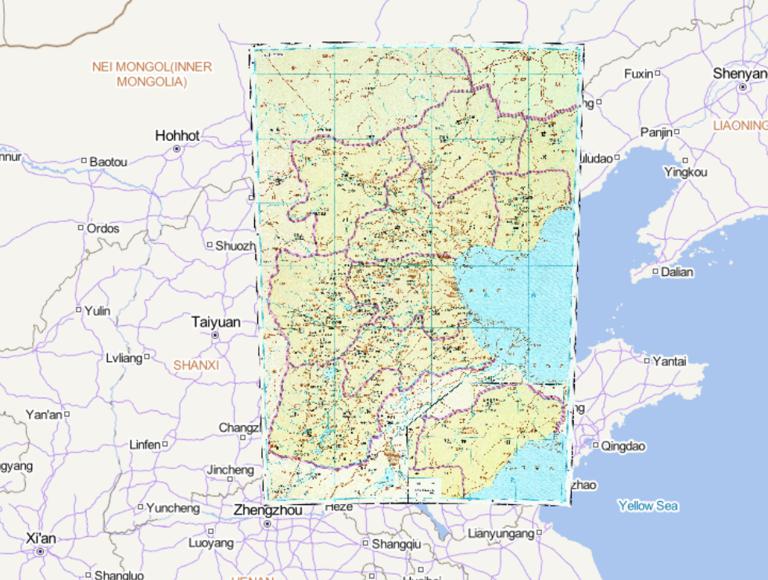
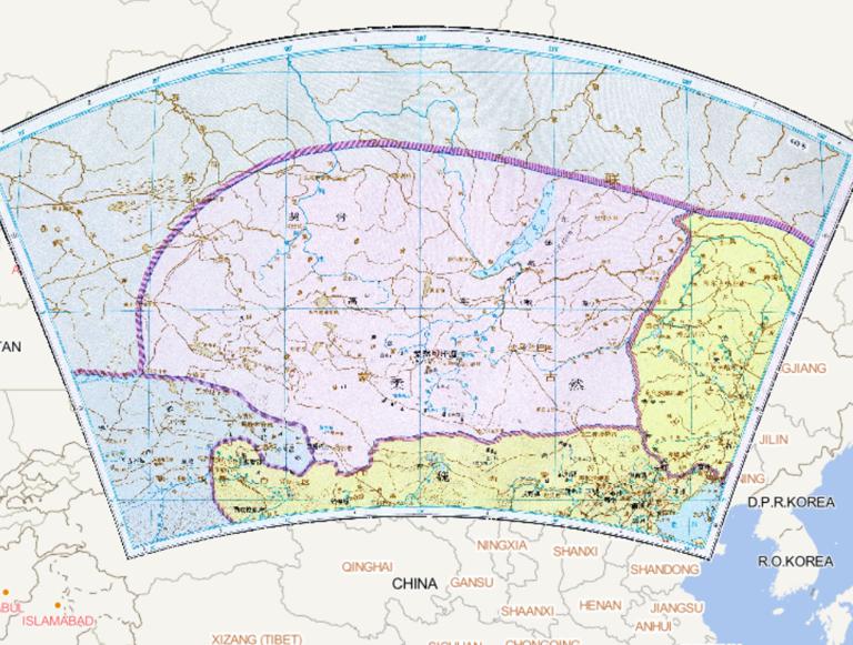
The Historical Map of Wei State Liangzhou in the Three Kingdoms Period of China
Map Introduction Background of Liang Province in the Late Eastern Han Geography and Ethnic Composition: Liang Province's juri...2016-10-24 11:29:00 UTC![History of Qi and Yizhou in the Southern Dynasties of China]()
History of Qi and Yizhou in the Southern Dynasties of China
Map Introduction The Historical Evolution of Yi Province during the Southern Qi Dynasty (479–502 AD) The historical evolution o...2016-10-24 11:29:00 UTC![History of Wei, Xiangzhou and other states in the Northern Dynasties]()
History of Wei, Xiangzhou and other states in the Northern Dynasties
Map Introduction Historical Evolution of Xiangzhou (Weizhou) The establishment of Xiangzhou (Weizhou) began in the second year...2016-10-24 11:29:00 UTC![Historical maps of Qi, Si state, Yong state, Ning Man residence during the Southern Dynasties of China]()
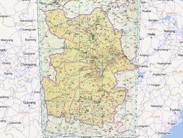
Historical maps of Qi, Si state, Yong state, Ning Man residence during the Southern Dynasties of China
Map Introduction Sizhou (Si Province) Sizhou was first established during the Cao Wei period of the Three Kingdoms, with its a...2016-10-24 11:29:00 UTC![The Historical Map of Ningzhou in the Western Jin Dynasty of China]()
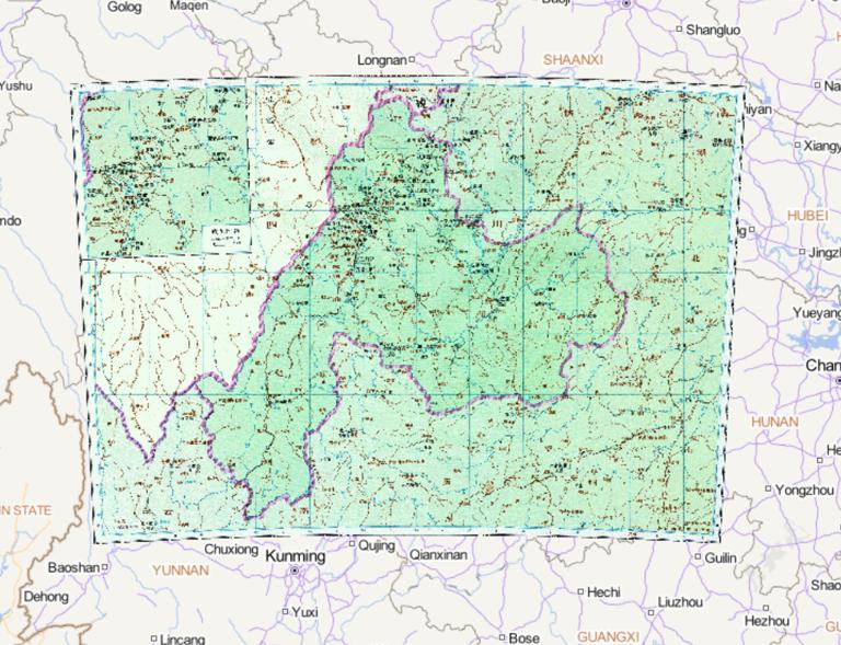
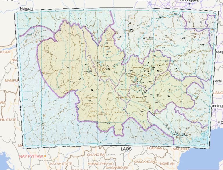
The Historical Map of Ningzhou in the Western Jin Dynasty of China
Map Introduction Ning Province during the Western Jin Dynasty Ning Province was an administrative division established by the W...2016-10-24 11:29:00 UTC![The Historical Map of Liangzhou in the Western Jin Dynasty of China]()
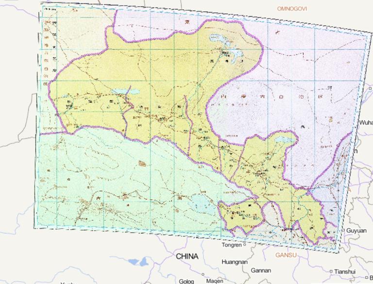
The Historical Map of Liangzhou in the Western Jin Dynasty of China
Map Introduction The historical evolution of Liang Province during the Western Jin Dynasty (265–316 AD) can be examined across ...2016-10-24 11:29:00 UTC![Historical Map of Wu State in Yangzhou During the Three Kingdoms Period of China]()
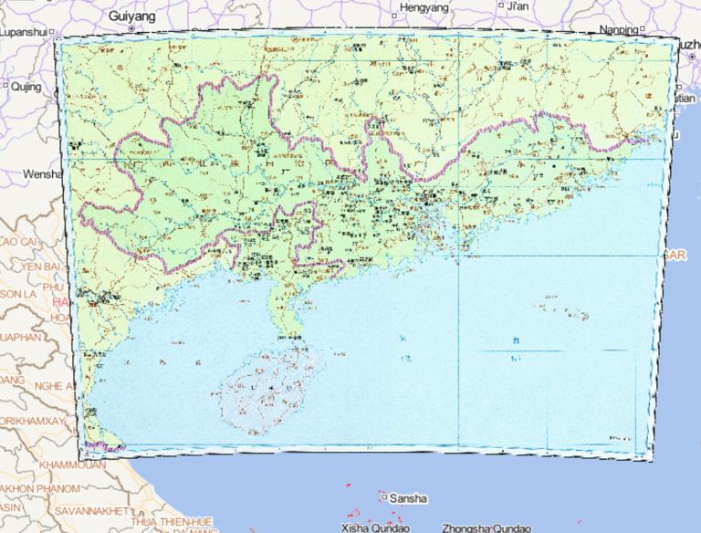
Historical Map of Wu State in Yangzhou During the Three Kingdoms Period of China
Map Introduction The historical evolution of Yang Province under the rule of the Wu state during the Three Kingdoms period (220...2016-10-24 11:29:00 UTC![Historical map of Weiwuchuan and Yuyi towns in Northern and Southern Dynasties in China]()
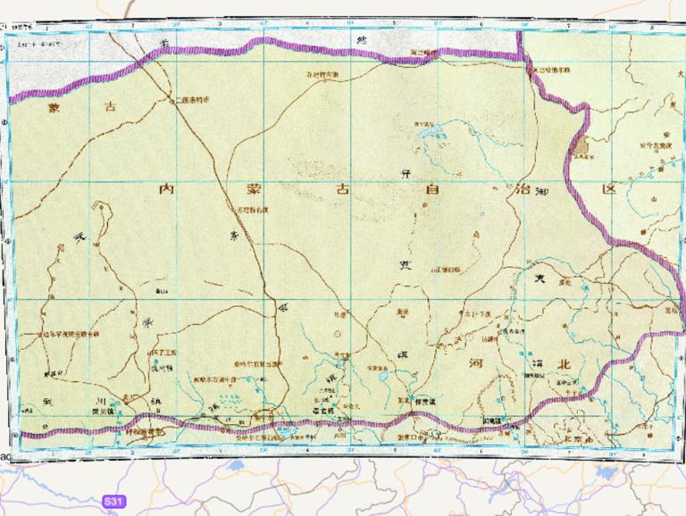
Historical map of Weiwuchuan and Yuyi towns in Northern and Southern Dynasties in China
Map Introduction Background of Establishment To defend against incursions from the Rouran, the Northern Wei Dynasty established...2016-10-24 11:29:00 UTC![The Historical Map of Jingzhou during the Western Jin Dynasty in China]()
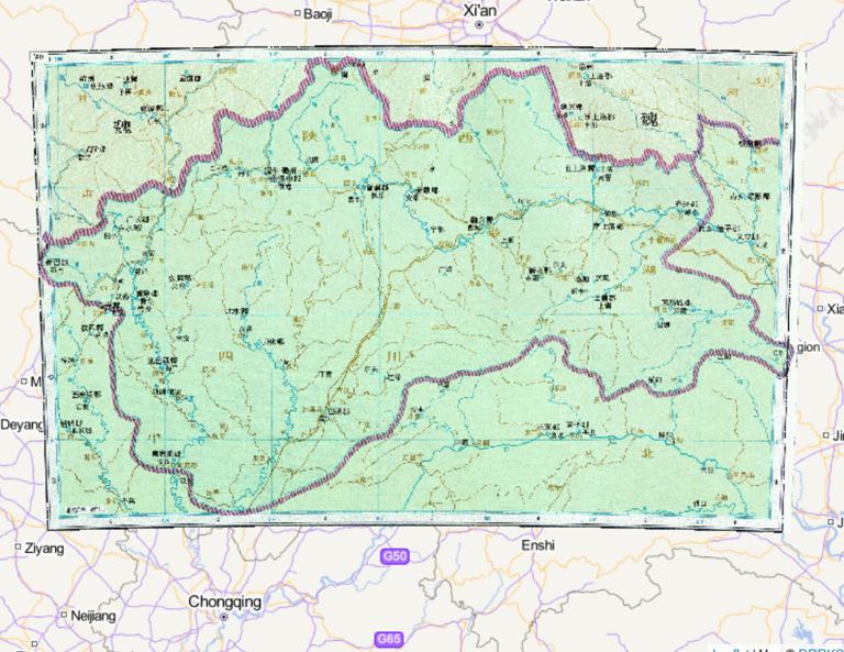
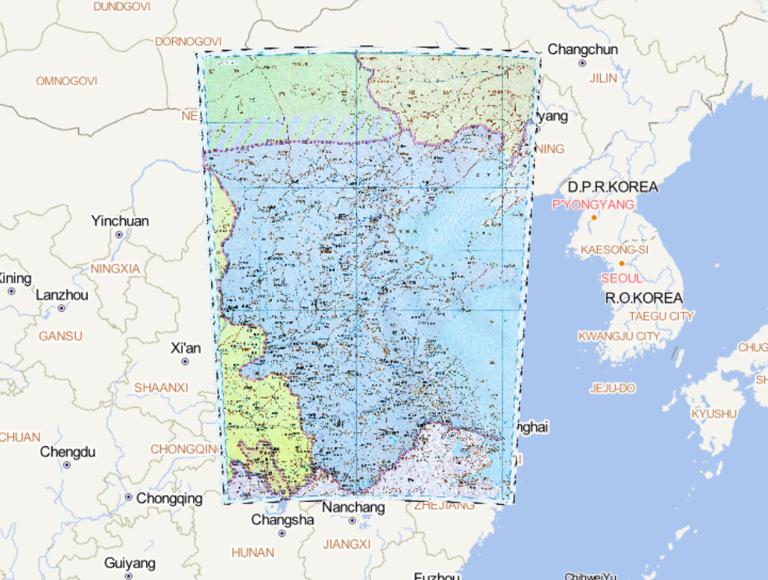
The Historical Map of Jingzhou during the Western Jin Dynasty in China
Map Introduction Administrative Adjustments Following its establishment, the Western Jin designated Jing Province as one of its...2016-10-24 11:29:00 UTC![The History Map of Qiliang and Qinzhou in the Southern Dynasty]()
The History Map of Qiliang and Qinzhou in the Southern Dynasty
Map Introduction During the Southern Qi (479–502 AD) and Liang (502–557 AD) dynasties, the evolution of provincial-level admini...2016-10-24 11:29:00 UTC![Historical map of China during the Northern and Southern Dynasties Rouran]()
Historical map of China during the Northern and Southern Dynasties Rouran
Map Introduction The Rouran were a nomadic tribal confederation active on the Mongolian Plateau from the 4th to the 6th centuri...2016-10-24 11:29:00 UTC![The Historical map of Qi Guang State and Yue State in the Southern Dynasties during the Southern and Northern Dynasties in China]()
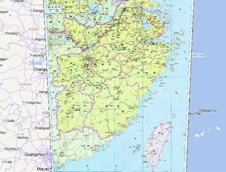
The Historical map of Qi Guang State and Yue State in the Southern Dynasties during the Southern and Northern Dynasties in China
Map Introduction Administrative Evolution of Guangzhou during the Southern Qi Dynasty As the core administrative district of Li...2016-10-24 11:29:00 UTC![The northern dynasties Qi country historical map]()
The northern dynasties Qi country historical map
Map Introduction Establishment (550 AD) Gao Yang usurped the throne of the Eastern Wei and established the Northern Qi dynasty,...2016-10-24 11:29:00 UTC![The Historical Map of Yangzhou during the Western Jin Dynasty in China]()
The Historical Map of Yangzhou during the Western Jin Dynasty in China
Map Introduction Administrative Reorganization Following the Western Jin Dynasty's conquest of Eastern Wu, the Yang Province te...2016-10-24 11:29:00 UTC

- Pre-Qin Historical Maps 22
- Qin and Han Dynasties Historical Maps 36
- Three Kingdoms, Two Jins, Southern and Northern Dynasties 66
- Sui, Tang, and Five Dynasties Period 54
- Song, Liao, Western Xia, and Jin Period 46
- Yuan Dynasty Historical Maps 21
- Ming Dynasty Historical Maps 29
- Qing Dynasty Historical Maps 27
- Modern Maps