![Historical maps of wei country, Chongzhou, Yuzhou and yangzhou in three kingdoms period of China]()
Historical maps of wei country, Chongzhou, Yuzhou and yangzhou in three kingdoms period of China
Map Introduction Yan Province * Geographical Scope: Roughly covering modern western Shandong and eastern Henan provinces. Its a...2016-10-24 11:29:00 UTC![The Historical Map of Zhouguo in Northern Dynasties]()
The Historical Map of Zhouguo in Northern Dynasties
Map Introduction Historical Evolution of the Northern Zhou (557–581 AD) ** Foundation of the Regime and Initial Instability** T...2016-10-24 11:29:00 UTC![China 's Sixteen States pre Liang, pre Qin , pre Yan of the historical map]()
China 's Sixteen States pre Liang, pre Qin , pre Yan of the historical map
Map Introduction Former Liang (317–376 AD) * Founding: Amid the collapse of the Western Jin, Zhang Gui, the Governor of Liang P...2016-10-24 11:29:00 UTC![Historical map of Jiaozhou , Guangzhou in Western Jin Dynasty in China]()
Historical map of Jiaozhou , Guangzhou in Western Jin Dynasty in China
Map Introduction The evolution of Jiao Province and Guang Province during the Western Jin period primarily involved administrat...2016-10-24 11:29:00 UTC![History map of Shuhan,south yizhou(commanding officer of Lai xiang)during the Three Kingdoms Period]()
History map of Shuhan,south yizhou(commanding officer of Lai xiang)during the Three Kingdoms Period
Map Introduction The Laixiang Military Governorship was a hybrid military-administrative institution established by the Shu Han...2016-10-24 11:29:00 UTC![The history map of Qi dynasty Jingzhou, Yingzhou and Xiangzhou during the Southern Dynasties]()
The history map of Qi dynasty Jingzhou, Yingzhou and Xiangzhou during the Southern Dynasties
Map Introduction The evolution of Jing, Ying, and Xiang Provinces during the Southern Qi period reflects the complex political ...2016-10-24 11:29:00 UTC![China in the northern and southern dynasties period, In southern qi and Jiangzhou historical maps]()
China in the northern and southern dynasties period, In southern qi and Jiangzhou historical maps
Map Introduction Jiang Province during the Southern Qi Dynasty (479–502 AD) Jiang Province, with its administrative seat at Xun...2016-10-24 11:29:00 UTC![The historical map of Wei Bing state, Si state, Heng state, Shuo state, etc. in the Northern Dynasties of China]()
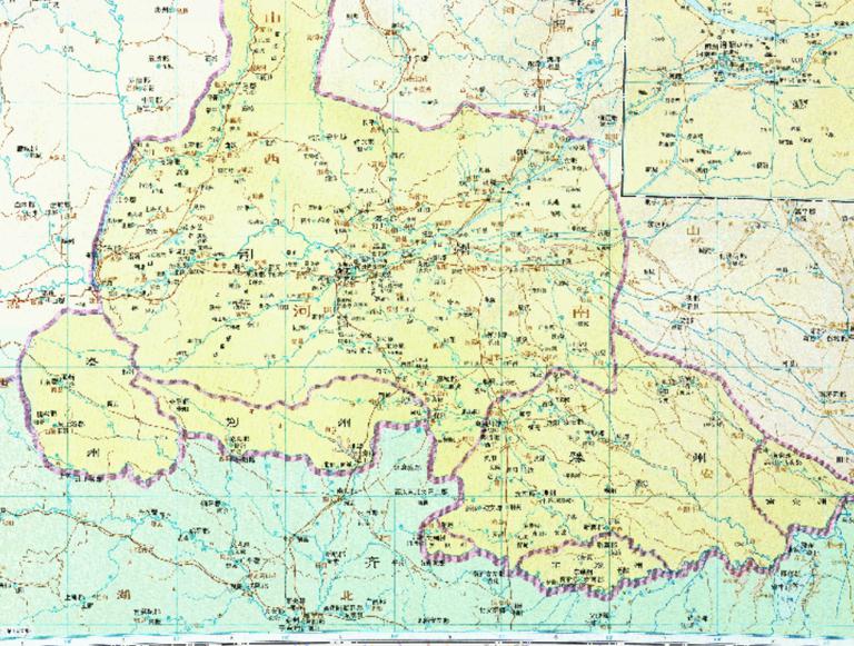
The historical map of Wei Bing state, Si state, Heng state, Shuo state, etc. in the Northern Dynasties of China
Map Introduction Bingzhou During the Northern Wei Dynasty, Bingzhou was a first-level administrative division, with its seat lo...2016-10-24 11:29:00 UTC![The historical map of Qin, Wei, South Liang, North Liang, west liang, south yan, Xia, West Qin, North Yan during in the Sixteen countries period]()
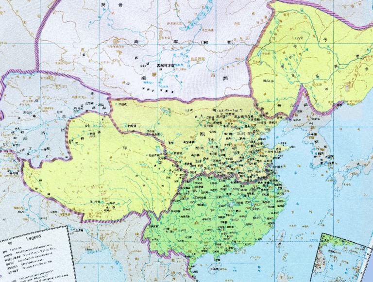
The historical map of Qin, Wei, South Liang, North Liang, west liang, south yan, Xia, West Qin, North Yan during in the Sixteen countries period
Map Introduction Later Qin Founded by the Qiang leader Yao Chang in 384 AD, with its capital at Chang'an. Initially a dependenc...2016-10-24 11:29:00 UTC![The Historical Map of the East Wei Dynasty in the Northern Dynasties]()
The Historical Map of the East Wei Dynasty in the Northern Dynasties
Map Introduction Eastern Wei (534–550 AD) was one of the Northern Dynasties regimes, formed from the division of the Northern W...2016-10-24 11:29:00 UTC![Historical map of wei country and qingzhou xuzhou in China's three kingdoms period]()
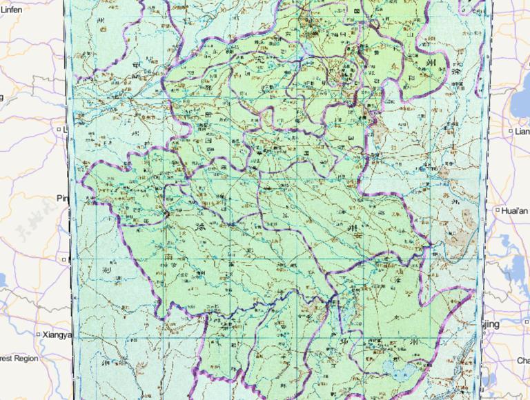
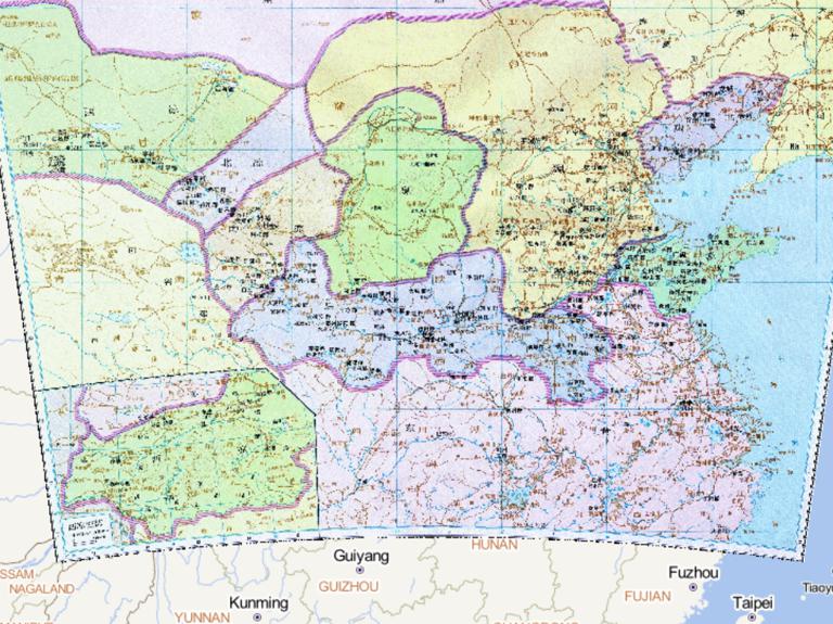
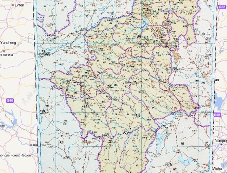
Historical map of wei country and qingzhou xuzhou in China's three kingdoms period
Map Introduction Qingzhou and Xuzhou during the Cao Wei period underwent complex evolution in terms of administrative divisions...2016-10-24 11:29:00 UTC![Map of Youzhou in Three Kingdoms period of China]()
Map of Youzhou in Three Kingdoms period of China
Map Introduction You Province You Province was a crucial provincial-level administrative district for the Cao Wei regime in the...2016-10-24 11:29:00 UTC![The History Map of Wu State 's and Jiaozhou in the Three Kingdoms Period of China]()
The History Map of Wu State 's and Jiaozhou in the Three Kingdoms Period of China
Map Introduction Jiao Province Jiao Province was a strategically important region under the effective control of Eastern Wu fro...2016-10-24 11:29:00 UTC![The Historical Map of Yanzhou and Yuzhou during the Western Jin Dynasty in China]()
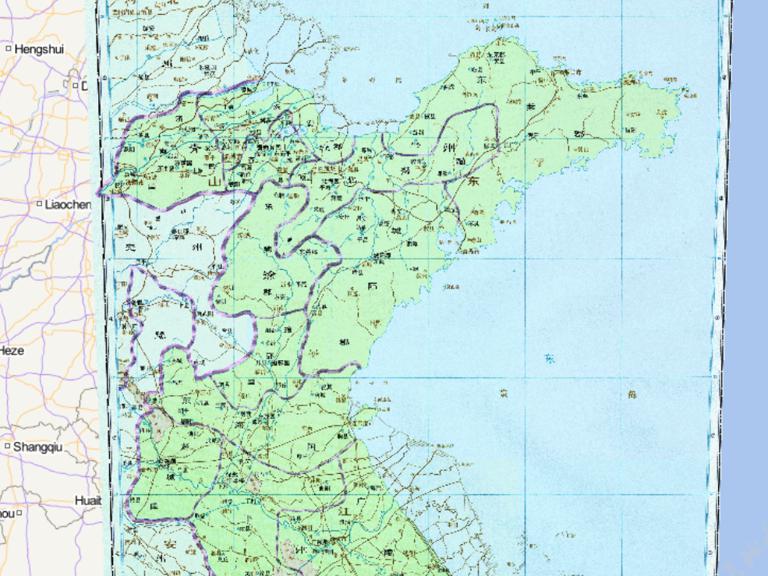
The Historical Map of Yanzhou and Yuzhou during the Western Jin Dynasty in China
Map Introduction Yan Province During the Jin Dynasty, the Yan Province Governor Department was established. It administered eig...2016-10-24 11:29:00 UTC![The Historical Maps of Qi and Wei Dynasties in China]()
The Historical Maps of Qi and Wei Dynasties in China
Map Introduction The historical evolution of the Southern Qi and Northern Wei dynasties reflects the complex processes of regim...2016-10-24 11:29:00 UTC![Historical map of Wei and Si state in Bei dynasty in China]()
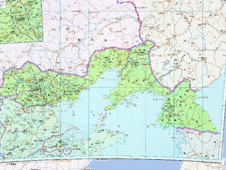
Historical map of Wei and Si state in Bei dynasty in China
Map Introduction Sizhou (Si Province) In the early Northern Wei period, the Office of the Colonel-Director of Retainers (Sili X...2016-10-24 11:29:00 UTC

- Pre-Qin Historical Maps 22
- Qin and Han Dynasties Historical Maps 36
- Three Kingdoms, Two Jins, Southern and Northern Dynasties 66
- Sui, Tang, and Five Dynasties Period 54
- Song, Liao, Western Xia, and Jin Period 46
- Yuan Dynasty Historical Maps 21
- Ming Dynasty Historical Maps 29
- Qing Dynasty Historical Maps 27
- Modern Maps