Navigation
HOME
Maps
Datasets
App
Literatures
Documents
Tutorial
Emergency Disaster Mitigation Services
Physical geography
Chinese Vegetation Regionalization Data
The Chinese Vegetation Regionalization Data is sourced from the 1:1,000,000 vegetation map. Vegetation regionalization involves...
2025-09-24
Spatial Distribution of China's Soil Types Data
The Spatial Distribution Dataset of China's Soil Types is digitally generated from the '1:1,000,000 Soil Map of the People's Re...
2025-09-24
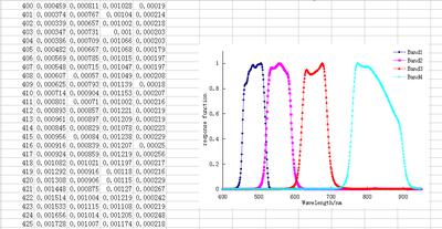
GF-1-16m Multispectral Camera 2-Spectral Response Function
This data is the GF-1-16m multispectral camera 2-spectral response function database, with a data size of 164KB. The data is st...
2025-09-24
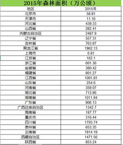
Forest area by region across China (2006–2015)
The dataset covers national forest area data from 2006 to 2015 across China, with a time span of 2006-2015. Applied in geograph...
2025-09-24
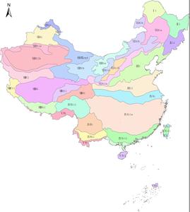
Provincial Administrative Boundary Data of China in 2015
This dataset includes data entities, metadata tables, thumbnails, and a data description document. It is applicable to research...
2025-09-24
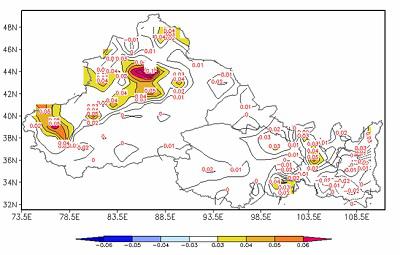
Spatiotemporal Dynamic Evolution of Vegetation in Northwest China (1982-2002)
The data set is Temporal and Spatial Dynamic Evolution of Vegetation in Northwest China and the data format is a png format. Th...
2025-09-24
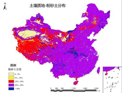
Spatial Distribution of Soil Texture in China - Silt Loam
The spatial distribution data of soil texture in China is compiled based on the 1:1,000,000 soil type map and soil profile data...
2025-09-24
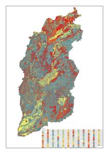
Shanxi Province Land Resource Dataset
This dataset includes land resource types, area measurements, and boundary delineations for Shanxi Province, China. The spatial...
2025-09-24
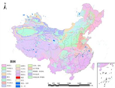
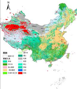
Spatial distribution data of vegetation types in China at a scale of 1:1,000,000
This dataset provides a detailed depiction of the distribution, horizontal zonality, and vertical zonality patterns of 796 form...
2025-09-24
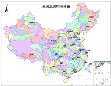
Spatial Distribution Data of Third-Order Watersheds in China
This dataset represents the spatial distribution of third-order watersheds in China, encompassing the spatial boundaries of 209...
2025-09-24
Dataset of Grassland Resource Types in China
The dataset compiles data on grassland types in China, primarily recording codes, grassland types, grassland area (in hectares)...
2025-09-24
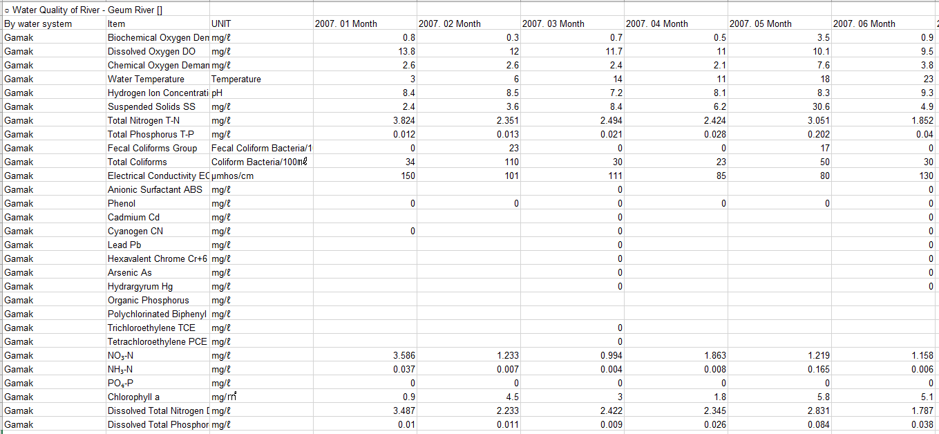
Water Quality Data of the Geum River Basin in South Korea (January 2007 to September 2018)
The dataset comprises water quality data for the Geum River Basin in South Korea, covering the time period from January 2007 to...
2025-09-24
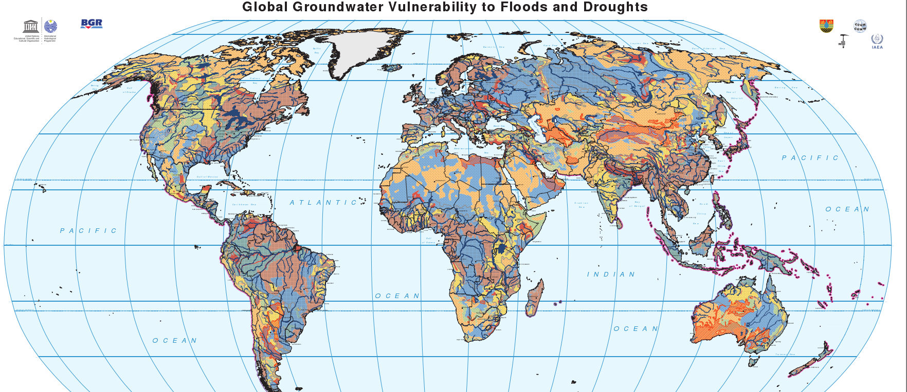
Global Groundwater Vulnerability to Floods and Droughts
The global map of groundwater vulnerability to floods and droughts illustrates the vulnerability level of Earth's groundwater r...
2025-09-24
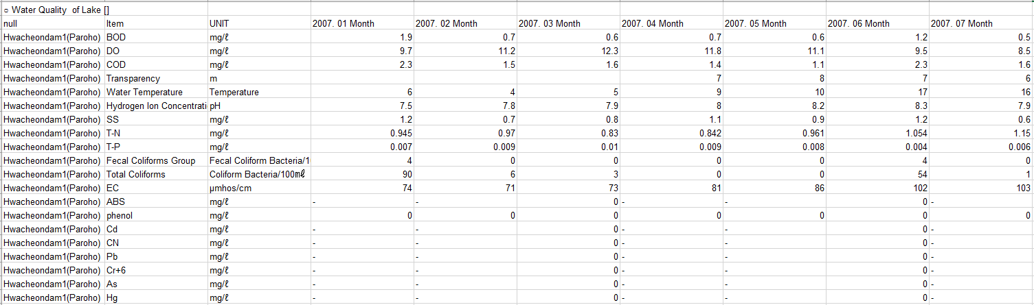
Korean lake water quality data
The dataset comprises Korean lake water quality data, covering the time period from January 2007 to September 2018, with a data...
2025-09-24
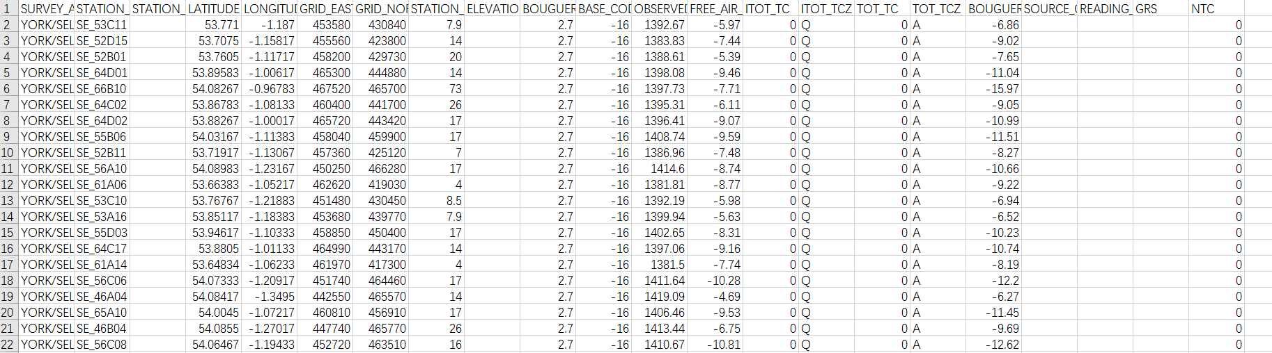
British land gravity survey
The database includes over 165,000 gravity observations conducted on land in Britain. The majority of the surveys were carried ...
2025-09-24
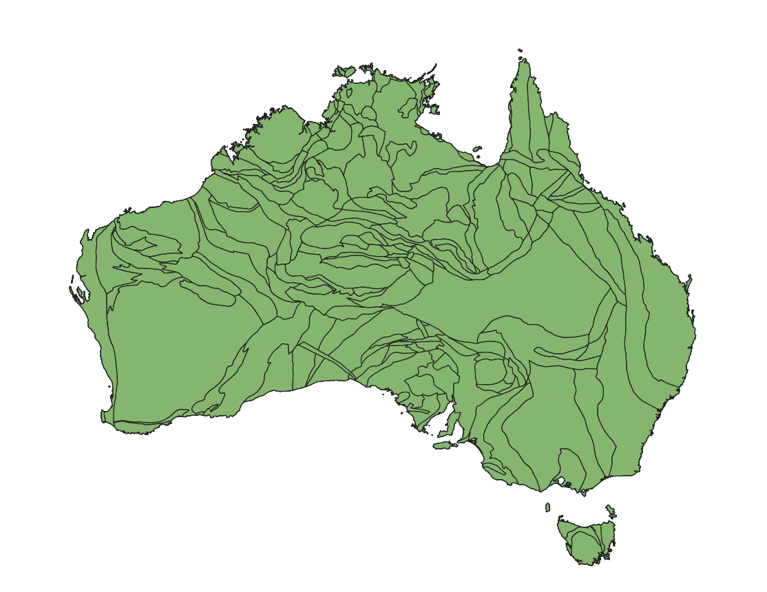
Australian Crustal Element Dataset
The Australian Crustal Element Dataset delineates upper crustal elements, primarily based on composite geophysical domains, eac...
2025-09-24
1
2
>
Dataset
Biological Science
Basic Geography
Physical Geography Data
Basic Statistical Data of Northeast Asia
Basic National Geographic Data for the Belt and Road Initiative
Ecology
Physical geography
Basic Geography
Socioeconomic
Statistical Data
Humanities and Social sciences
Natural Disaster
Agricultural Science
Meteorological Science
Northwest China
Northeast China
Loess Plateau
The northern Shaanxi region
The Qinghai-Tibet Plateau
Geographical region
Disciplinary classification data