最近几年来,地理信息系统无论是在理论上还是应用上都处在一个飞速发展的阶段。 GIS被应用于多个领域的建模和决策支持,如城市管理、区划、环境整治等等,地理信息成为信息时代重要的组成部分之一; “数字地球”概念的提出,更进一步推动了作为其技术支撑的GIS的发展。 与此同时,一些学者致力于相关的理论研究,如空间感知、空间数据误差、空间关系的形式化等等。 这恰好说明了地理信息系统作为应用技术和学科的两个方面,并且这两个方面构成了相互促进的发展过程。
9.40.1. Brief introduction 
Storyboards is only introduced in iOS5, and when we use Storyboards, the deployment target should be iOS5.0 or higher.
Storyboards helps us understand the visual flow of the picture, in the interface for
Create all application screens under MainStoryboard.storyboard. Example step =
1. 创建一个single view application,创建应用程序时选择 storyboard 复选框。
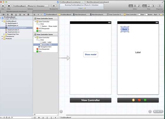
two。 Select MainStoryboard.storyboard, where you can find a single view controller. Add a view controller and update the view controller, as follows
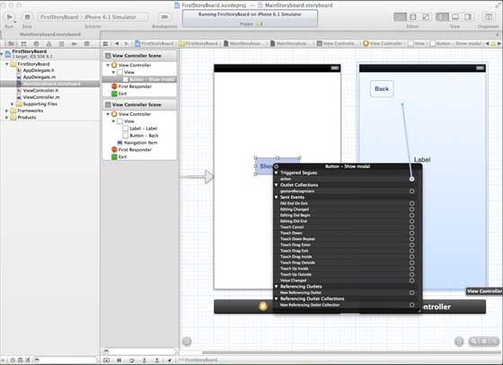
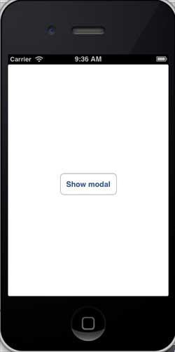
3.连接两个视图控制器。右键单击”show modal(显示模式)”按钮,在左侧视图控制器将其拖动到右视视图控制器中,如下图所示:
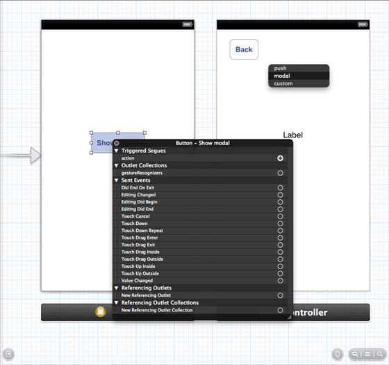
4.现在从如下所示的三个显示选项中选择modal(模态)
5.更新 ViewController.h 如下所示
#import @interface ViewController : UIViewController -(IBAction)done:(UIStoryboardSegue *)seque; @end 6.更新 ViewController.m 如下所示
#import "ViewController.h" @interface ViewController () @end @implementation ViewController - (void)viewDidLoad { [super viewDidLoad]; } - (void)didReceiveMemoryWarning { [super didReceiveMemoryWarning]; // Dispose of any resources that can be recreated. } -(IBAction)done:(UIStoryboardSegue *)seque{ [self.navigationController popViewControllerAnimated:YES]; } @end
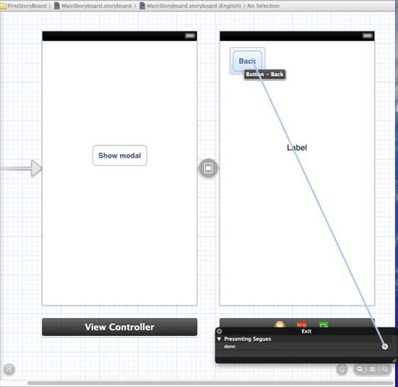
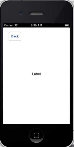
7.选择”MainStoryboard.storyboard”,并右键点击”Exit “按钮,在右侧视图控制器中选择和连接后退按钮,如下图所示
9.40.2. Output 
Run the application in the iPhone device and get the following output
Now, select the display mode and you will get the following output
-
1. Angularjs2
8
-
1. SVG tutorial
19
-
1. Memcached
20
-
1. C# tutorial
61
-
1. Sqlite
47
-
2. Go
43
-
2. Docker
59
-
2. Vue3
19
-
2. Servlet
21
-
3. React
23
-
3. SOAP tutorial
10
-
3. Android
18
-
3. Mongodb
44
-
3. Kotlin
18
-
4. Lua
31
-
4. MySQL tutorial
35
-
4. Appml
12
-
5. Perl
45
-
5. Postgresql
41
-
web
15
-
5. Web Services tutorial
6
-
6. Ruby
42
-
6. Design-pattern
35
-
7. Django
18
-
7. Rust
22
-
6. WSDL tutorial
8
-
8. Foundation
39
-
9. Ios
43
-
9.22. The use of IOS View switching
-
9.5. Create the first iPhone application
-
9.19. Use of table view
-
9.33. IOS sends email
-
9.31. IOS positioning operation
-
9.28. IOS accelerometer (accelerometer)
-
9.7. Delegate (Delegates) example
-
9.37. In-app purchase of IOS
-
>
9.40. IOS storyboard (Storyboards)
-
9.10. Why use different input types?
-
8. Css3
26
-
9. Swift
44
-
11. HTML tutorial-(HTML5 Standard)
54
-
12. Http
6
-
13. Regex
6
-
14. Regexp
8
-
1. Introduction to geographic information system
6
-
2. From the Real World to the Bit World
3
-
3. Spatial Data Model
7
-
4. 空间参照系统和 地图投影
5
-
5. Data in GIS
3
-
6. Spatial data acquisition
2
-
7. Spatial Data Management
6
-
8. Spatial analysis
8
-
9. 数字地形模型( DTM )与地形分析
5
-
10. 空间建模与 空间决策支持
6
-
11. Spatial data representation and map making
6
-
12. 3S Integration Technology
5
-
13. 网络地理信息系统
3
-
14. Examples of Geographic Information System Application
8
-
15. Organization and Management of Geographic Information System Application Projects
9
-
16. Geographic Information system Software Engineering Technology
6
-
17. Geographic Information System Standards
3
-
18. Geographic Information System and Society
3
-
19. Earth Information Science and Digital Earth
3