In many cases, we need to do some regular repetitive operations, so we need to repeat some statements in the program.
A group of statements that are repeatedly executed are called loop bodies, and whether they can be repeated or not determines the termination conditions of the loop.
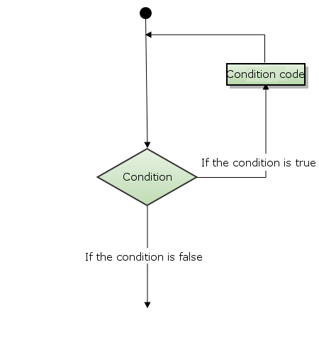
The loop structure is the process structure that repeatedly executes a certain program under certain conditions, and the program that is executed repeatedly is called the loop body.
The loop statement consists of two parts: the body of the loop and the termination condition of the loop.
Lua language provides the following loop processing methods:
Cycle type | Description |
|---|---|
While cycle | Have the program execute certain statements repeatedly when the condition istrue. Check whether the condition is true before executing the statement. |
For cycle | The specified statement is executed repeatedly, and the number of repetitions can be controlled in the for statement. |
repeat…until | Repeat the loop until the specified condition is true |
Loop nesting | You can nest one or more loop statements within a loop (while do… End;for… Do… End;repeat… Until;) |
4.6.1. Loop control statement #
The loop control statement is used to control the flow of the program in order to realize the various structures of the program.
Lua supports the following loop control statements:
Control statement | Description |
|---|---|
Break statement | Exits the current loop or statement and starts the script to execute the following statement. |
Goto statement | Transfer the control point of the program to a label. |
4.6.2. Infinite cycle #
In the body of a loop, if the condition is always true , the loop statement will be executed forever, as follows while loops as an example:Example #
while( true ) do print("The loop will always execute") end