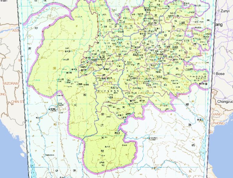
![The Historical Map of Yunnan Province during the Yuan Dynasty]()
The Historical Map of Yunnan Province during the Yuan Dynasty
Map Introduction Yunnan during the Yuan Dynasty In 1253, Kublai Khan of the Borjigin clan led his army across the Jinsha River ...2016-10-24 12:56:08 UTC![Historical Maps of Gansu Province during the Yuan Dynasty in China]()
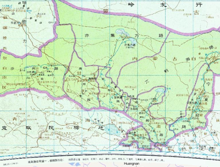
Historical Maps of Gansu Province during the Yuan Dynasty in China
Map Introduction I. Establishment Background and Timeline In 1281, the 18th year of the Zhiyuan era under Kublai Khan, the Gans...2016-10-24 12:56:08 UTC![Historical map of the Chinese Yuan Dynasty (Yuan 17, AD 1280)]()
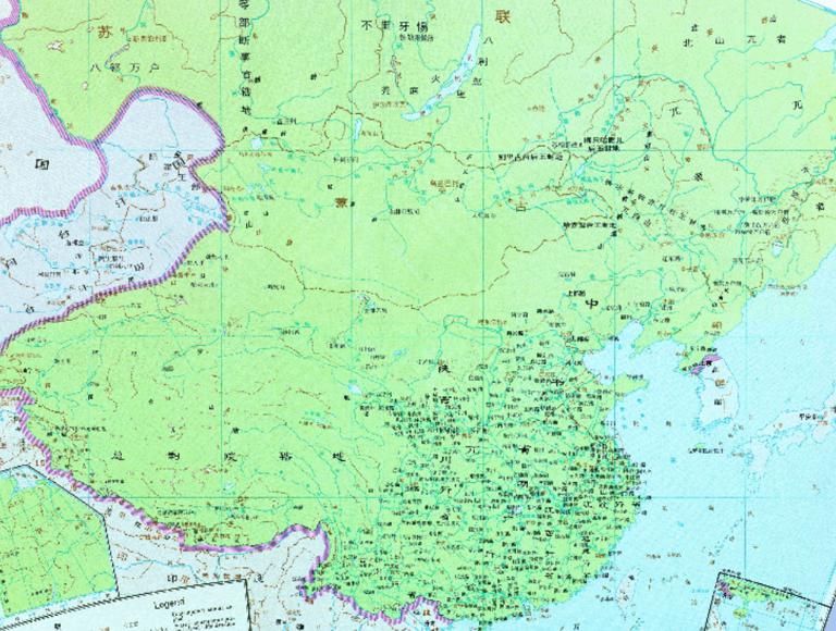
Historical map of the Chinese Yuan Dynasty (Yuan 17, AD 1280)
I. The Rise of the Mongols and the Establishment of the Yuan Dynasty In 1206, Temüjin unified the Mongol tribes and established...2016-10-24 12:56:04 UTC![Historical Maps of the 1330 Years of the Yuan Dynasty in China]()
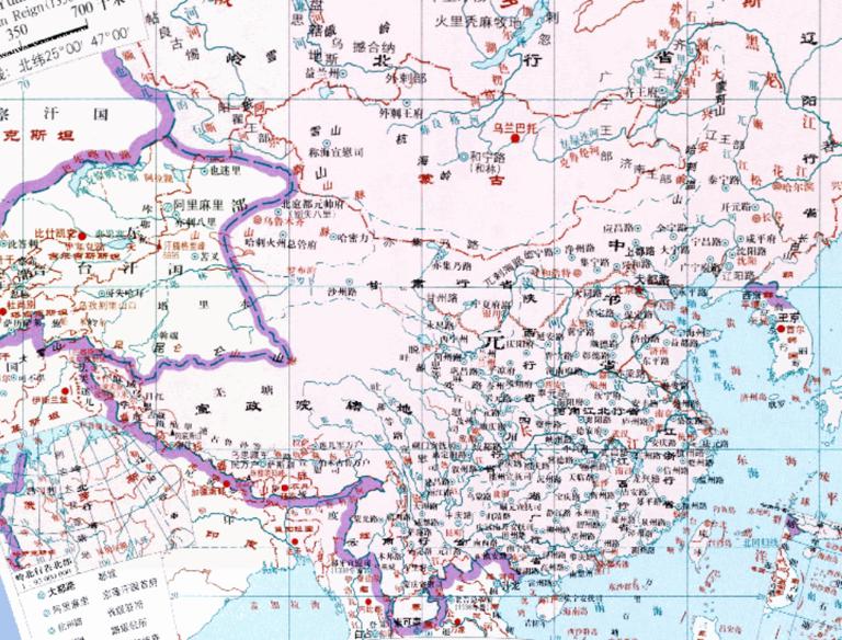
Historical Maps of the 1330 Years of the Yuan Dynasty in China
Map Introduction I. Political Landscape and Power Struggles The first year of the Zhishun era (1330) marked the third year of Y...2016-10-24 11:29:29 UTC![The Historical Map of Yunnan Province in Central during the Yuan Dynasty]()
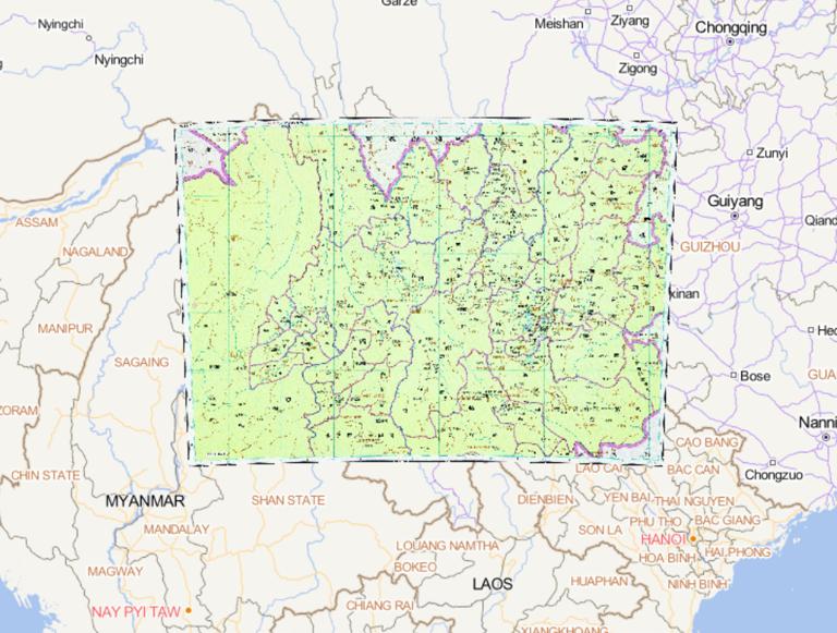
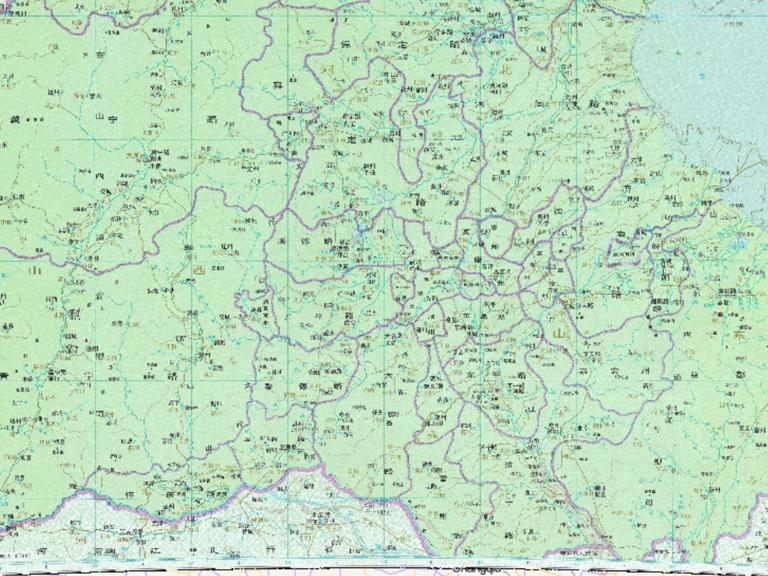
The Historical Map of Yunnan Province in Central during the Yuan Dynasty
Map Introduction I. Establishment Background and Administrative Structure After Kublai Khan's forces conquered the Dali Kingdom...2016-10-24 11:29:25 UTC![The Historical Maps of Sichuan Province during the Yuan Dynasty]()
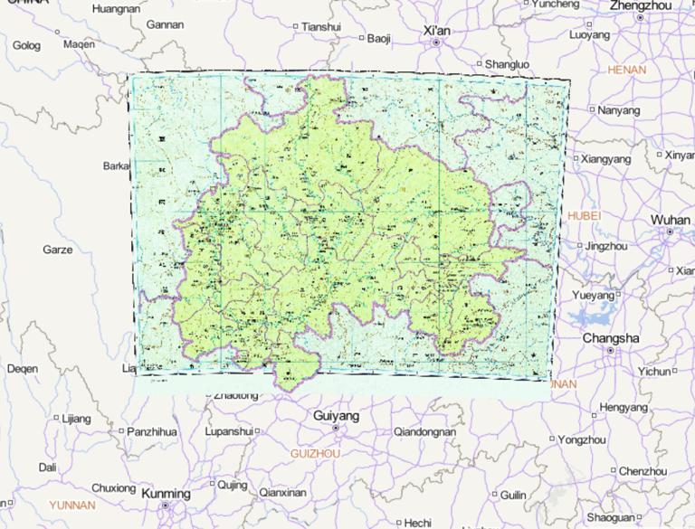
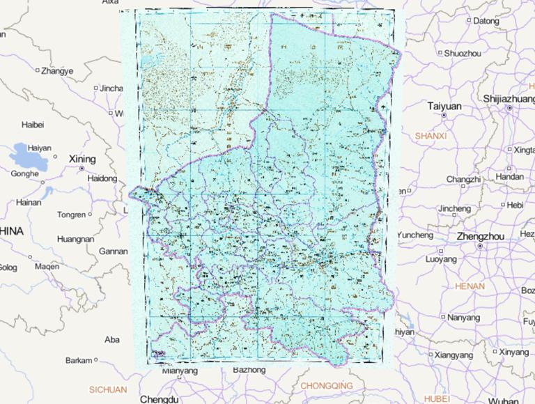
The Historical Maps of Sichuan Province during the Yuan Dynasty
Map Introduction I. Establishment Background and Initial Structure In 1260, the Yuan Dynasty established the Shaanxi-Sichuan Br...2016-10-24 11:29:25 UTC![The Historical Map of Jiangsu and Zhejiang Provinces during the Yuan Dynasty]()
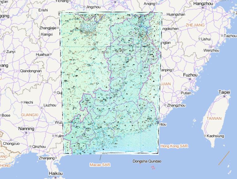
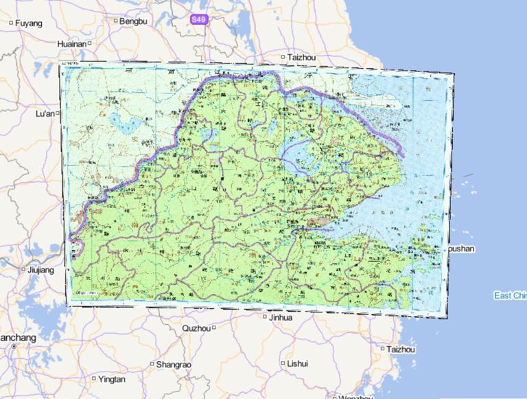
The Historical Map of Jiangsu and Zhejiang Provinces during the Yuan Dynasty
Map Introduction I. Establishment Background and Initial Jurisdiction The Jiangzhe Branch Secretariat was one of the eleven Bra...2016-10-24 11:29:25 UTC![Historical Maps of Jiangxi Province in the Yuan Dynasty]()
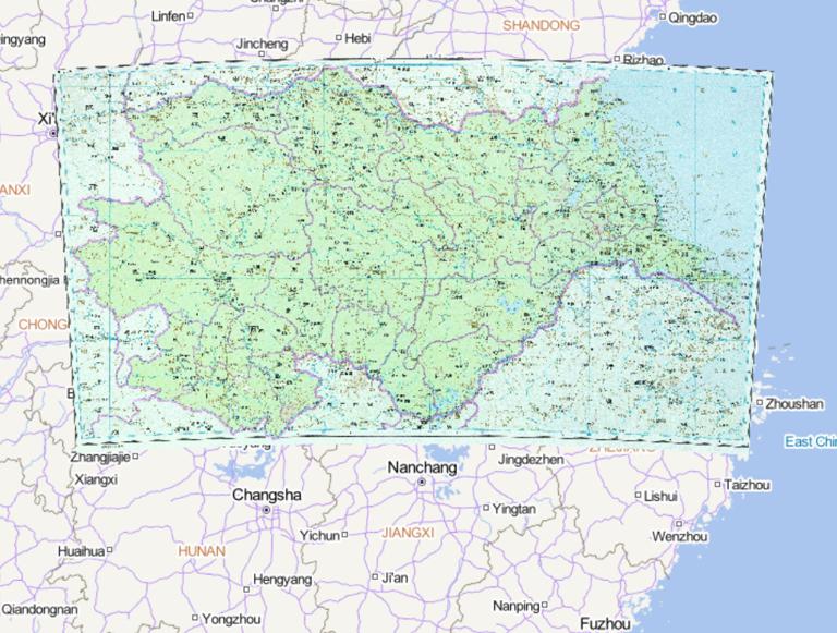
Historical Maps of Jiangxi Province in the Yuan Dynasty
Map Introduction I. Establishment Background and Basic Information To strengthen control over the southern regions, the Yuan Dy...2016-10-24 11:29:25 UTC![The Historical Map of Beiten in Gansu Province of the Yuan Dynasty]()
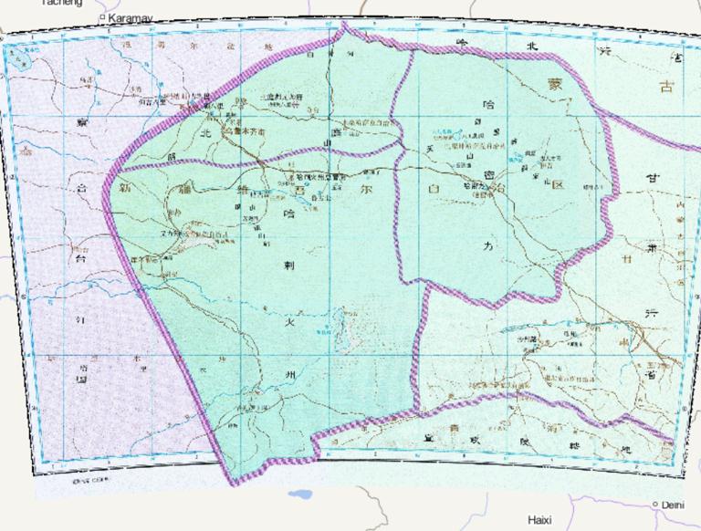
The Historical Map of Beiten in Gansu Province of the Yuan Dynasty
Map Introduction I. Hami: The Strategic Gateway on the Silk Road Hami (modern Hami region) during the Yuan Dynasty was the appa...2016-10-24 11:29:25 UTC![The Historical Map of Northern Jiangsu and Zhejiang Provinces during the Yuan Dynasty]()
The Historical Map of Northern Jiangsu and Zhejiang Provinces during the Yuan Dynasty
Map Introduction I. Geographic Scope and Administrative Divisions The Jiangzhe Branch Secretariat (full name: Branch Secretaria...2016-10-24 11:29:25 UTC![The Historical Map of Lingbei Province during the Yuan Dynasty]()
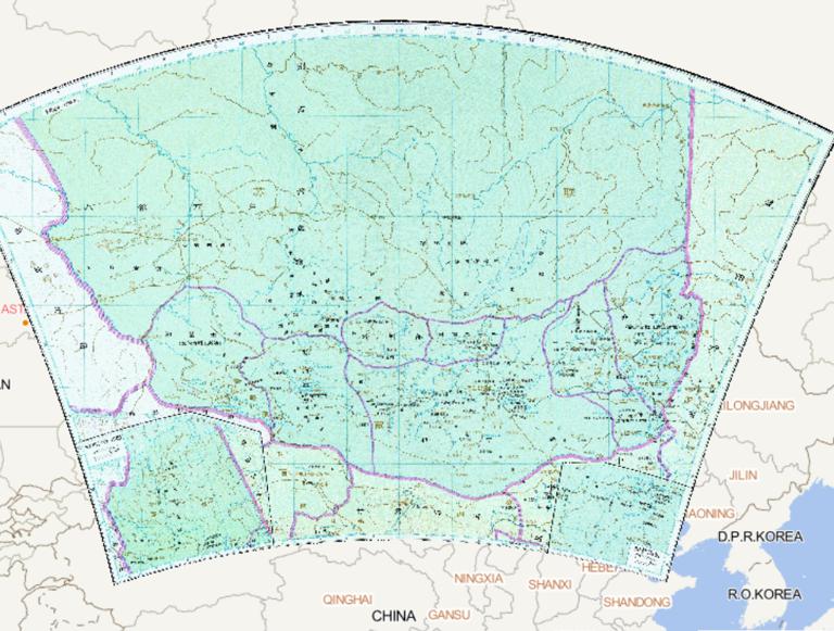
The Historical Map of Lingbei Province during the Yuan Dynasty
Map Introduction I. Establishment and Geographical Scope The Lingbei Branch Secretariat was one of the ten major Branch Secreta...2016-10-24 11:29:25 UTC![Historical map of yuan dynasty near the capital]()
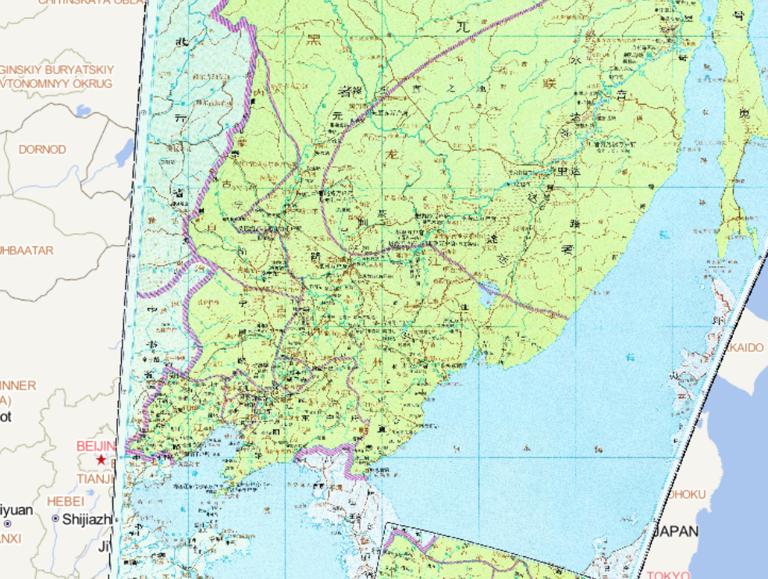
Historical map of yuan dynasty near the capital
Map Introduction I. Establishment Background and Initial Functions The Central Secretariat of the Yuan Dynasty was the supreme ...2016-10-24 11:29:25 UTC![Chinese Yuan Dynasty Zhongshusheng Southern historical map]()
Chinese Yuan Dynasty Zhongshusheng Southern historical map
Map Introduction I. Geographic Scope and Administrative Characteristics of the Southern Central Secretariat As the supreme admi...2016-10-24 11:29:25 UTC![The Historical Map of Shaanxi Province in the Yuan Dynasty]()
The Historical Map of Shaanxi Province in the Yuan Dynasty
Map Introduction I. Establishment Background and Evolution of Administrative Divisions The establishment of the Shaanxi Branch ...2016-10-24 11:29:25 UTC![The Historical Map of Liaoyang Province during the Yuan Dynasty]()
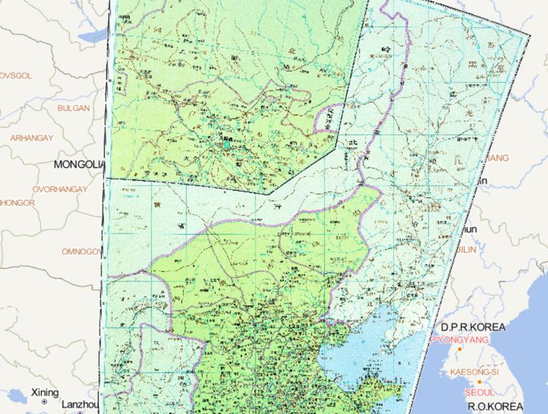
The Historical Map of Liaoyang Province during the Yuan Dynasty
Map Introduction I. Establishment Background and Initial Setup The establishment of the Liaoyang Branch Secretariat originated ...2016-10-24 11:29:25 UTC![The Historical Map of Henan Jiangbei Province during the Yuan Dynasty]()
The Historical Map of Henan Jiangbei Province during the Yuan Dynasty
Map Introduction I. Establishment Background and Jurisdictional Scope The Henan Jiangbei Branch Secretariat was a provincial-le...2016-10-24 11:29:25 UTC
- Pre-Qin Historical Maps 22
- Qin and Han Dynasties Historical Maps 36
- Three Kingdoms, Two Jins, Southern and Northern Dynasties 66
- Sui, Tang, and Five Dynasties Period 54
- Song, Liao, Western Xia, and Jin Period 46
- Yuan Dynasty Historical Maps 21
- Ming Dynasty Historical Maps 29
- Qing Dynasty Historical Maps 27
- Modern Maps