Loess Plateau
![Remote Sensing Dataset of Soil Erosion on the Loess Plateau (1987-1990)]()
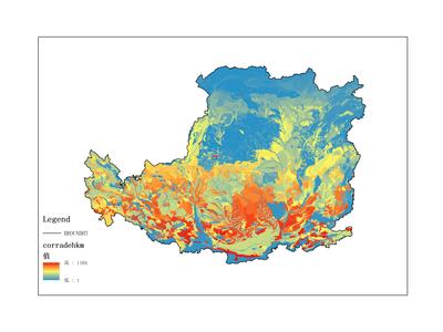
Remote Sensing Dataset of Soil Erosion on the Loess Plateau (1987-1990)
The dataset primarily records soil erosion data on the Loess Plateau, covering the time period from 1987 to 1990. The data form...2026-01-22 00:58:32 UTC![Remote Sensing Dataset of Land Use on the Loess Plateau (1987-1990)]()
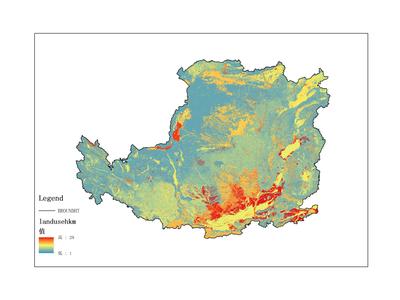
Remote Sensing Dataset of Land Use on the Loess Plateau (1987-1990)
The dataset primarily records land use data on the Loess Plateau, covering the time period from 1987 to 1990. The data format i...2026-01-22 00:58:31 UTC![Remote Sensing Dataset of Soil Resources and Environment on the Loess Plateau (1987-1990)]()
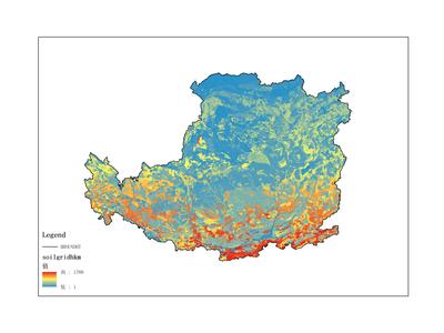
Remote Sensing Dataset of Soil Resources and Environment on the Loess Plateau (1987-1990)
The dataset primarily records forest resource data, spanning the time period from 1987 to 1990. The data is in raster format. I...2026-01-22 00:58:30 UTC