
logo

Shanxi Province Land Resource Dataset

Shanxi Province Land Resource Dataset

发布时间:2025年9月24日 16:37

类别:

Page Views: 9 views

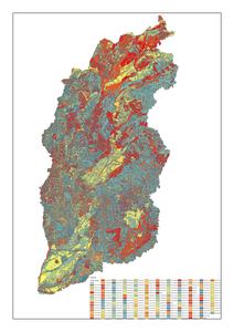
This dataset includes land resource types, area measurements, and boundary delineations for Shanxi Province, China. The spatial data is projected using the Clarke_1866_Albers coordinate system, ensuring high accuracy for regional land resource analysis.
title
山西省土地资源数据集
format
矢量数据
anytext
数据量:14.8MB
abstract
山西省土地资源数据集,采用Clarke_1866_Albers投影,数据包括土地资源类型、面积和边界。服务对象包括从事土地研究的科技工作者,也适用于政府决策部门。
keywords
山西省,土地资源
language
中文
operation
数据来源于遥感图像,数据通过ArcGIS进行处理,并利用ArcGIS SHP进行数据的导出和呈现。
publisher
data@iga.ac.cn
field_name
value
identifier
wa75c
organization
中国科学院地理与资源环境研究所,地址:北京市朝阳区大屯路甲11号
topicategory
地理科学,环境科学,区域可持续发展,地球科学
distancevalue
该数据集的覆盖地区为山西省。
resourcelanguage
中文
accessconstraints
开放式共享
语言
zh CN
类型
Vector Data
格式
.shp