发布时间 :2026-01-22 00:58:36 UTC
类别 : Physical geography
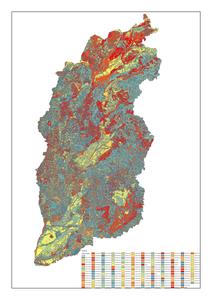
This dataset includes land resource types, area measurements, and boundary delineations for Shanxi Province, China. The spatial data is projected using the Clarke_1866_Albers coordinate system, ensuring high accuracy for regional land resource analysis.